If you’re anything like us, you love a good map. You may have even drawn a few in your life. Come visit the Warren Heritage Society and see some beauties!
Two of our favorites:
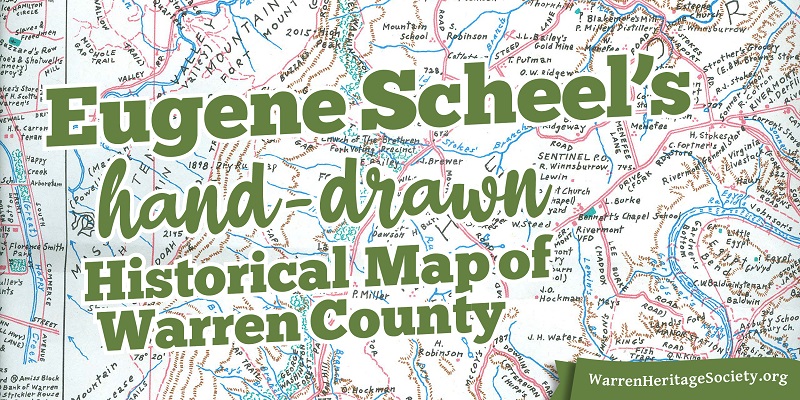
Eugene Scheel’s incredibly detailed, lovingly hand-drawn 3’ x 3’ map of Warren County (compiled from 2005 to 2011), which can be purchased at the Warren Heritage Society for $15. This map overlays historical buildings and land deeds onto a modern travel map. Come back to the Archives to see it!
Dick Richardson’s painting of Chester Street, available in the Ivy Lodge Gift Shop. This charming print brings 1800s Front Royal to life.
Our graphic shows a portion of the Eugene Scheel Warren County map. Mr. Scheel did extensive research by traveling through the county, talking with long time residents, and looking at old land records and maps. This map shows mills, mines, graveyards, the Shenandoah River, and many other sites for the local history adventurer! It’s worth a visit to examine up close.
We have several other maps on display including Front Royal/Riverton, some print maps showing the Battle of Guard Hill (May 23, 1862), and a 1936 map of Warren County. And Mr. Scheel made a number of fascinating regional maps. (Read more about him here and here.)